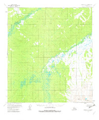
1954 Map of Medfra C-5
USGS Topo · Published 1982About this map
The Sunshine Mountains dominate the southeastern corner of this Interior Alaska landscape, rising above a complex network of waterways and wetlands. Based on surveys from the early 1950s, the map reveals the intricate, winding path of the Susulatna River as it traverses the northwestern sector. Across the central and eastern portions, the Nowitna River creates a broad corridor of marshy lowlands and hundreds of small, unnamed ponds. This topography is characteristic of the remote subarctic wilderness between the Kuskokwim and Yukon drainages, where the lack of roads or established settlements emphasizes a landscape shaped entirely by natural drainage patterns and glacial history.
Find a feature on this map
3 named features on this map. Tap any name to fly to it.
Don’t see what you’re looking for? This feature index may not catch every label — zoom into the map to look around manually.
Map Details
Editions of this 1954 Medfra C-5 Map
3 editions found
Other maps of this area

1950 · Medfra
USGS Topo · 1:250,000

1953 · Medfra B-4
USGS Topo · 1:63,360

1953 · Medfra B-5
USGS Topo · 1:63,360

1953 · Medfra C-4
USGS Topo · 1:63,360

1954 · Medfra C-6
USGS Topo · 1:63,360

1954 · Medfra C-5
USGS Topo · 1:63,360

1954 · Medfra D-5
USGS Topo · 1:63,360

1954 · Medfra D-6
USGS Topo · 1:63,360

1954 · Medfra B-6
USGS Topo · 1:63,360
1954 · Medfra D-4
USGS Topo · 1:63,360