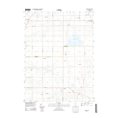
2013 Map of Meeker
USGS Topo · Published 2013About this map
Harpster and Meeker anchor this corner of North Central Ohio, where the flat expanse of the Sandusky Plains meets a complex network of agricultural drainage and headwater streams. The landscape is defined by its rectilinear township and range grid, yet it is punctuated by a high density of small family and community burial grounds, such as Hunt Cem and Stansbery Cem, which provide essential clues for genealogical research in Wyandot and Marion Counties. The map reveals the modern intersection of traditional farming and 21st-century water management, seen in the contrast between historic settlements like Brownstown and the large-scale Killdeer Upground Reservoir. Waterways like Tymochtee Cr and Prairie Run meander through the terrain, flanked by significant agricultural operations such as Sims Farms and Ralph Brothers Farms.
Find a feature on this map
87 named features on this map. Tap any name to fly to it.
Don’t see what you’re looking for? This feature index may not catch every label — zoom into the map to look around manually.
Map Details
Editions of this 2013 Meeker Map
This is the sole edition of this map. No revisions or reprints were ever made.
Other maps of this area

1903 · Marion
USGS Topo · 1:62,500

1905 · Marion
USGS Topo · 1:62,500

1906 · Sycamore
USGS Topo · 1:62,500

1907 · Upper Sandusky
USGS Topo · 1:62,500

1915 · La Rue
USGS Topo · 1:62,500

1950 · Marion
USGS Topo · 1:250,000

1960 · Nevada
USGS Topo · 1:24,000
1960 · Morral
USGS Topo · 1:24,000

1960 · Upper Sandusky
USGS Topo · 1:24,000

1960 · Marseilles
USGS Topo · 1:24,000