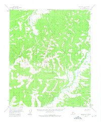
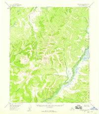
1954 Map of Melozitna B-5
USGS Topo · Published 1975About this map
Dulbatna Mountain rises as a central landmark in this mid-century survey of the Alaskan interior, north of the Yukon River. The landscape is defined by the winding course of the Nayuka River in the northwest and the Dulbi River valley in the southeast. This 1954 mapping effort, based on 1952 aerial photography, documents a wilderness area largely devoid of permanent settlements or roads. The presence of the Base Line and high-altitude survey points like VABM 2748 Table reflect the systematic effort by the Geological Survey and Bureau of Land Management to map unsurveyed territories. Along the drainage of Radio Creek, the topography transitions into complex wetland systems and swampy basins characteristic of the region's river-fed lowlands.
Find a feature on this map
6 named features on this map. Tap any name to fly to it.
Don’t see what you’re looking for? This feature index may not catch every label — zoom into the map to look around manually.
Map Details
Editions of this 1954 Melozitna B-5 Map
2 editions found
Other maps of this area

1951 · Melozitna
USGS Topo · 1:250,000
1952 · Melozitna A-6
USGS Topo · 1:63,360

1953 · Melozitna A-4
USGS Topo · 1:63,360
1954 · Melozitna A-5
USGS Topo · 1:63,360

1954 · Melozitna C-4
USGS Topo · 1:63,360
1954 · Melozitna B-4
USGS Topo · 1:63,360

1954 · Melozitna C-5
USGS Topo · 1:63,360

1954 · Melozitna C-6
USGS Topo · 1:63,360
1954 · Melozitna B-5
USGS Topo · 1:63,360
1954 · Melozitna B-6
USGS Topo · 1:63,360