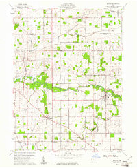
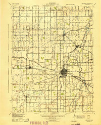
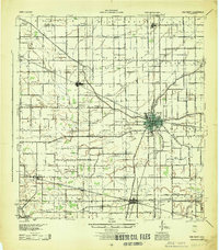
1960 Map of Mendon
USGS Topo · Published 1961About this map
The ST Marys River winds across the center of this 1960s landscape, illustrating the hydrological and agricultural patterns of West Central Ohio. The village of Mendon serves as a local hub, supported by the Waterworks and connected by the New York Central railroad. The surrounding rural townships, including Liberty, Union, and Dublin, are defined by a network of drainage ditches such as Yankee Ditch and Frisinger Ditch, which converted the former Great Black Swamp region into productive farmland.
Find a feature on this map
73 named features on this map. Tap any name to fly to it.
Don’t see what you’re looking for? This feature index may not catch every label — zoom into the map to look around manually.
Map Details
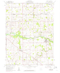
Editions of this 1960 Mendon Map
2 editions found
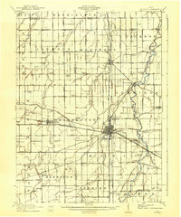
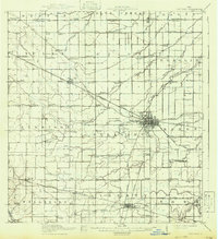
Other maps of this area

1911 · Spencerville
USGS Topo · 1:62,500
1911 · Delphos
USGS Topo · 1:62,500

1914 · Celina
USGS Topo · 1:62,500
1914 · Van Wert
USGS Topo · 1:62,500
1944 · Delphos
USGS Topo · 1:62,500
1944 · Van Wert
USGS Topo · 1:62,500

1944 · Celina
USGS Topo · 1:62,500

1944 · Spencerville
USGS Topo · 1:62,500

1953 · Muncie
USGS Topo · 1:250,000

1956 · Muncie
USGS Topo · 1:250,000