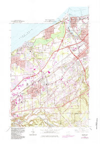
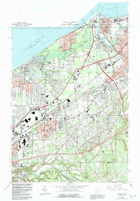
1963 Map of Mentor
USGS Topo · Published 1984About this map
The Lake Erie shoreline and the industrial corridor of the Grand River define this mid-century portrait of Lake County. Heavy industry is concentrated near Fairport Harbor and Painesville, where numerous Salt Wells are mapped alongside the Conrail lines. The residential development of Mentor and Mentor-on-the-Lake is well underway, supported by a dense network of local schools like Morton Sch and Salida Sch, and the emerging campus of Lakeland Community College.
Find a feature on this map
48 named features on this map. Tap any name to fly to it.
Don’t see what you’re looking for? This feature index may not catch every label — zoom into the map to look around manually.
Map Details
Editions of this 1963 Mentor Map
5 editions found
Other maps of this area

1904 · Chardon
USGS Topo · 1:62,500

1905 · Perry
USGS Topo · 1:62,500

1905 · Mentor
USGS Topo · 1:62,500

1906 · Chardon
USGS Topo · 1:62,500

1907 · Mentor
USGS Topo · 1:62,500

1950 · Cleveland
USGS Topo · 1:250,000

1953 · Chardon
USGS Topo · 1:24,000
1953 · Mayfield Heights
USGS Topo · 1:24,000

1953 · Chesterland
USGS Topo · 1:24,000

1953 · Mentor
USGS Topo · 1:24,000