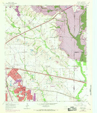
1959 Map of Mesquite
USGS Topo · Published 1969About this map
The Texas and Pacific RR and the Missouri Kansas and Texas RR intersect at the heart of Mesquite, anchoring a landscape in rapid transition. Purple revision tinting shows the town's expansion toward New Hope and Northridge Sch, while the outlying areas of Sunnyvale and Rose Hill remain dominated by agricultural grid lines and family-named landmarks like E S Ranch. To the east, the East Fork Trinity River flows through a broad bottomland, now partially submerged by the western edge of Lake Ray Hubbard. This 1959 survey, updated in 1968, documents the suburban transformation of Dallas County before the full build-out of the Interstate system. Significant community nodes like Macedonia Ch and the Wildwood Cem provide essential anchor points for genealogical research, while the presence of several Gravel Pits along the river indicates the local industrial activity supporting the era's regional growth.
Find a feature on this map
85 named features on this map. Tap any name to fly to it.
Don’t see what you’re looking for? This feature index may not catch every label — zoom into the map to look around manually.
Map Details
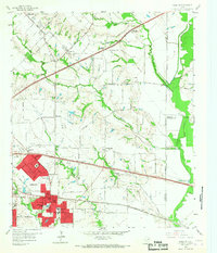
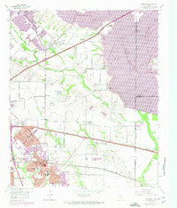
Editions of this 1959 Mesquite Map
4 editions found

Other maps of this area

1891 · Dallas
USGS Topo · 1:125,000

1893 · Dallas
USGS Topo · 1:125,000

1912 · Rockwall
USGS Topo · 1:31,680

1919 · Royse City
USGS Topo · 1:62,500

1954 · Dallas
USGS Topo · 1:250,000

1956 · Kaufman
USGS Topo · 1:62,500

1957 · White Rock Lake
USGS Topo · 1:24,000

1958 · Dallas
USGS Topo · 1:250,000

1958 · Hutchins
USGS Topo · 1:24,000

1958 · White Rock Lake
USGS Topo · 1:24,000