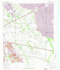
1959 Map of Mesquite
USGS Topo · Published 1974About this map
Mesquite and Sunnyvale emerge as rapidly growing suburban centers in this mid-century survey, which documents the landscape just as the massive Lake Ray Hubbard reservoir begins to dominate the eastern horizon. The area's agricultural past is still visible in the scattered farms and named ranch sites like E-S Ranch, even as new residential developments and schools like Florence Black Sch and Agnew Jr High Sch signal a shift toward suburbanization. The infrastructure of the era is anchored by the Texas and Pacific railroad and the curiously named World War II Highway, while older community hubs such as Rose Hill and the Wildwood Cem provide a look at the established rural social structure before the reservoir's waters altered the local geography.
Find a feature on this map
70 named features on this map. Tap any name to fly to it.
Don’t see what you’re looking for? This feature index may not catch every label — zoom into the map to look around manually.
Map Details
Editions of this 1959 Mesquite Map
4 editions found

Other maps of this area

1891 · Dallas
USGS Topo · 1:125,000

1893 · Dallas
USGS Topo · 1:125,000

1912 · Rockwall
USGS Topo · 1:31,680

1919 · Royse City
USGS Topo · 1:62,500

1954 · Dallas
USGS Topo · 1:250,000

1956 · Kaufman
USGS Topo · 1:62,500

1957 · White Rock Lake
USGS Topo · 1:24,000

1958 · Dallas
USGS Topo · 1:250,000

1958 · Hutchins
USGS Topo · 1:24,000

1958 · White Rock Lake
USGS Topo · 1:24,000