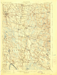
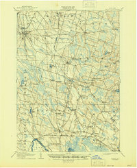
1905 Map of Mexico
USGS Topo · Published 1925About this map
The Rome Watertown and Ogdensburg RR serves as a primary transit corridor through this northern New York landscape at the beginning of the twentieth century. The village of Mexico stands as a focal point in the northwest, while the southeastern corner is defined by the marshy fringes of Big Bay Oneida L. The map reveals a dense network of hamlets and crossroad settlements such as Colosse, Union Square, and Central Square, which suggest a well-established rural economy reliant on both rail access and local water power. Industrial remnants are visible at Carley Mills and Graves Millpond, where the Little Salmon River and its tributaries were harnessed. This survey by J.H. Jennings and Gilbert Young captures a distinct era of inland commerce before modern highway expansion altered the settlement patterns of Oswego County.
Find a feature on this map
72 named features on this map. Tap any name to fly to it.
Don’t see what you’re looking for? This feature index may not catch every label — zoom into the map to look around manually.
Map Details
Editions of this 1905 Mexico Map
6 editions found

Other maps of this area

1895 · Chittenango
USGS Topo · 1:62,500

1895 · Pulaski
USGS Topo · 1:62,500

1895 · Syracuse
USGS Topo · 1:62,500

1898 · Syracuse
USGS Topo · 1:62,500

1898 · Chittenango
USGS Topo · 1:62,500

1900 · Baldwinsville
USGS Topo · 1:62,500

1900 · Fulton
USGS Topo · 1:62,500

1902 · Chittenango
USGS Topo · 1:62,500

1903 · Orwell
USGS Topo · 1:62,500

1905 · Orwell
USGS Topo · 1:62,500