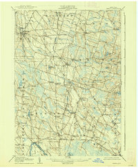
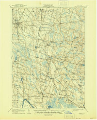
1905 Map of Mexico
USGS Topo · Published 1938About this map
Mexico and the surrounding townships of Richland and Hastings are defined by a complex network of waterways and early rail lines at the turn of the century. The Rome Watertown and Ogdensburg RR cuts through the northern landscape, serving established hubs like Union Square and Parish, while the New York Ontario and Western RR skirts the southern edge near Central Square. The terrain is marked by numerous glacial features, including drumlins that redirect the flow of the Salmon River and Little Salmon River.
Find a feature on this map
77 named features on this map. Tap any name to fly to it.
Don’t see what you’re looking for? This feature index may not catch every label — zoom into the map to look around manually.
Map Details
Editions of this 1905 Mexico Map
6 editions found

Other maps of this area

1895 · Chittenango
USGS Topo · 1:62,500

1895 · Pulaski
USGS Topo · 1:62,500

1895 · Syracuse
USGS Topo · 1:62,500

1898 · Syracuse
USGS Topo · 1:62,500

1898 · Chittenango
USGS Topo · 1:62,500

1900 · Baldwinsville
USGS Topo · 1:62,500

1900 · Fulton
USGS Topo · 1:62,500

1902 · Chittenango
USGS Topo · 1:62,500

1903 · Orwell
USGS Topo · 1:62,500

1905 · Orwell
USGS Topo · 1:62,500