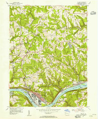
1954 Map of Midland
USGS Topo · Published 1955About this map
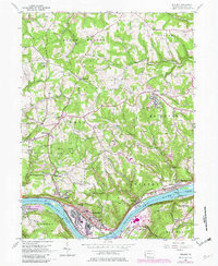
The Ohio River dominates this mid-century landscape, serving as the industrial and logistical spine for settlements like Midland and Industry. Large-scale infrastructure is evident in the Montgomery Dam and Lock and Dam No 7, while the town of Midland shows significant development around the Lincoln High Sch and Fourth St Sch. The interior hills are dotted with rural landmarks such as Salem Ch, Mt Cedar Ch, and the Oak Grove Ch, alongside scattered educational sites like the Potter Twp Sch.
Find a feature on this map
68 named features on this map. Tap any name to fly to it.
Don’t see what you’re looking for? This feature index may not catch every label — zoom into the map to look around manually.
Map Details
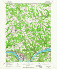
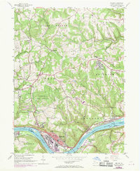
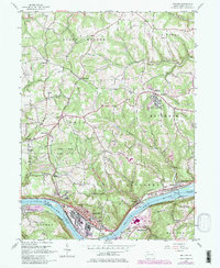
Editions of this 1954 Midland Map
5 editions found
Other maps of this area

1901 · Beaver
USGS Topo · 1:62,500

1902 · New Castle
USGS Topo · 1:62,500

1904 · Newcastle
USGS Topo · 1:62,500

1904 · Wellsville
USGS Topo · 1:62,500

1904 · Beaver
USGS Topo · 1:62,500

1907 · Columbiana
USGS Topo · 1:62,500

1909 · Columbiana
USGS Topo · 1:62,500

1937 · Wellsville
USGS Topo · 1:62,500

1944 · Wellsville
USGS Topo · 1:62,500

1951 · Canton
USGS Topo · 1:250,000