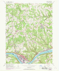
1954 Map of Midland
USGS Topo · Published 1969About this map
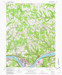
The industrial corridor along the Ohio River defines this 1950s landscape, centered on the concentrated manufacturing and rail infrastructure of Midland. Extensive oil tanks and a massive industrial footprint near Lincoln High Sch contrast with the rugged, wooded drainages of the surrounding townships. Across the water, Shippingport sits at a strategic bend, while the Montgomery Dam and its locks regulate the river traffic of the Penn Central rail era.
Find a feature on this map
72 named features on this map. Tap any name to fly to it.
Don’t see what you’re looking for? This feature index may not catch every label — zoom into the map to look around manually.
Map Details
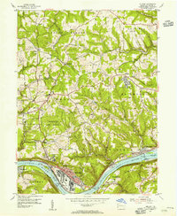
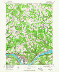
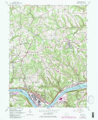
Editions of this 1954 Midland Map
5 editions found
Other maps of this area

1901 · Beaver
USGS Topo · 1:62,500

1902 · New Castle
USGS Topo · 1:62,500

1904 · Newcastle
USGS Topo · 1:62,500

1904 · Wellsville
USGS Topo · 1:62,500

1904 · Beaver
USGS Topo · 1:62,500

1907 · Columbiana
USGS Topo · 1:62,500

1909 · Columbiana
USGS Topo · 1:62,500

1937 · Wellsville
USGS Topo · 1:62,500

1944 · Wellsville
USGS Topo · 1:62,500

1951 · Canton
USGS Topo · 1:250,000