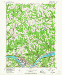
1954 Map of Midland
USGS Topo · Published 1968About this map
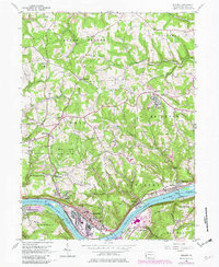
The Ohio River corridor defines the industrial and residential character of this mid-century survey, with the dense riverside development of Midland standing in sharp contrast to the wooded ridges of the Pennsylvania Game Commission lands. Heavily influenced by the river economy, the landscape features significant infrastructure including Lock and Dam No 7 and the Montgomery Dam, which regulate the vital waterway near Georgetown Island.
Find a feature on this map
59 named features on this map. Tap any name to fly to it.
Don’t see what you’re looking for? This feature index may not catch every label — zoom into the map to look around manually.
Map Details
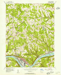
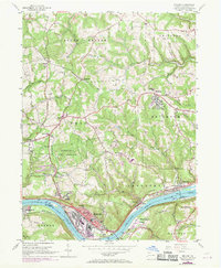
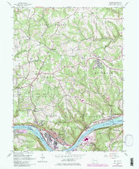
Editions of this 1954 Midland Map
5 editions found
Other maps of this area

1901 · Beaver
USGS Topo · 1:62,500

1902 · New Castle
USGS Topo · 1:62,500

1904 · Newcastle
USGS Topo · 1:62,500

1904 · Wellsville
USGS Topo · 1:62,500

1904 · Beaver
USGS Topo · 1:62,500

1907 · Columbiana
USGS Topo · 1:62,500

1909 · Columbiana
USGS Topo · 1:62,500

1937 · Wellsville
USGS Topo · 1:62,500

1944 · Wellsville
USGS Topo · 1:62,500

1951 · Canton
USGS Topo · 1:250,000