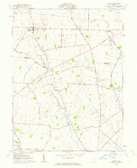
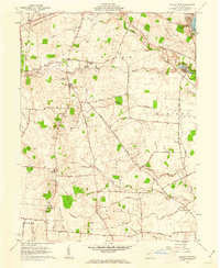
1961 Map of Midway
USGS Topo · Published 1963About this map
Midway (Sedalia PO) anchors this early 1960s agricultural survey, situated within the unique historical geography of the Virginia Military District. The landscape is defined by the convergence of the North Fork Paint Creek and East Fork Paint Creek, where the small settlement of Yatesville sits just north of the Union Chapel. Local family history is etched into the terrain through several scattered burial grounds, including Bethel Cem, Counts Cem, and Vesey Cem. This area of Madison and Fayette counties maintains a strictly rural character, with the township of Range and various small creeks like Cheneweth Creek and Thompson Creek connected by a dense network of early roads such as Chillicothe Road and Foster Redman Road. Unlike much of the surrounding region, this map also depicts several prominent industrial pipelines cutting across the northern farmsteads.
Find a feature on this map
41 named features on this map. Tap any name to fly to it.
Don’t see what you’re looking for? This feature index may not catch every label — zoom into the map to look around manually.
Map Details
Editions of this 1961 Midway Map
2 editions found
Other maps of this area

1906 · Mt Sterling
USGS Topo · 1:62,500

1907 · London
USGS Topo · 1:62,500

1907 · South Charleston
USGS Topo · 1:62,500

1916 · Octa
USGS Topo · 1:62,500

1944 · Octa
USGS Topo · 1:62,500

1947 · Columbus
USGS Topo · 1:250,000

1961 · Columbus
USGS Topo · 1:250,000
1961 · Florence
USGS Topo · 1:24,000
1961 · Big Plain
USGS Topo · 1:24,000
1961 · Walnut Run
USGS Topo · 1:24,000