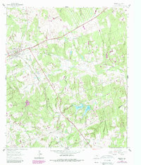
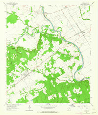
1962 Map of Milano
USGS Topo · Published 1989About this map
The rail junction at Milano serves as the primary hub in this corner of Milam County, where the landscape is defined by a dense network of watercourses and early-1960s energy exploration. Numerous Oil Wells are scattered across the terrain, indicating the mid-century industrial footprint near the Milam Co Burleson Co line. Rural life centers on landmarks like Sand Grove Ch and Friendship Ch, while genealogists will find the locations of Sand Point Cem and Hurt Cem essential for tracing local family histories. The physical geography is complex, carved by branches and creeks such as Yellow Rabbit Creek and Sugar Mill Branch, which flow toward the southern boundary. This edition also highlights the Newton Lakes and the small community of Elevation, capturing the transition from traditional agricultural land use to more intensive resource extraction during the postwar era.
Find a feature on this map
32 named features on this map. Tap any name to fly to it.
Don’t see what you’re looking for? This feature index may not catch every label — zoom into the map to look around manually.
Map Details
Editions of this 1962 Milano Map
2 editions found
Other maps of this area

1954 · Austin
USGS Topo · 1:250,000

1956 · Caldwell
USGS Topo · 1:62,500

1956 · Milano
USGS Topo · 1:62,500
1961 · Caldwell
USGS Topo · 1:24,000

1961 · Hanover
USGS Topo · 1:24,000

1961 · Cameron
USGS Topo · 1:24,000

1961 · Rockdale East
USGS Topo · 1:24,000

1962 · Goodwill
USGS Topo · 1:24,000
1962 · Chriesman
USGS Topo · 1:24,000
1962 · Gause
USGS Topo · 1:24,000