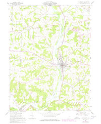
1961 Map of Millersburg
USGS Topo · Published 1978About this map
Killbuck Creek dominates the center of this Ohio landscape, flowing past the county seat of Millersburg. The village serves as a vital junction for the Pennsylvania railroad line, which follows the river valley through the town's industrial and residential center. To the west and south, the terrain is marked by numerous drainage runs and small tributary creeks such as Shrimplin Creek and Corns Run, while the historic Greenville Treaty Line cuts across the northern townships, preserving a significant 18th-century surveying boundary on the modern map.
Find a feature on this map
32 named features on this map. Tap any name to fly to it.
Don’t see what you’re looking for? This feature index may not catch every label — zoom into the map to look around manually.
Map Details
Editions of this 1961 Millersburg Map
4 editions found
Other maps of this area

1912 · Loudonville
USGS Topo · 1:62,500

1913 · Brinkhaven
USGS Topo · 1:62,500

1913 · Coshocton
USGS Topo · 1:62,500

1914 · Loudonville
USGS Topo · 1:62,500

1915 · Brinkhaven
USGS Topo · 1:62,500

1915 · Millersburg
USGS Topo · 1:62,500

1915 · Coshocton
USGS Topo · 1:62,500

1943 · Millersburg
USGS Topo · 1:62,500

1943 · Coshocton
USGS Topo · 1:62,500

1943 · Loudonville
USGS Topo · 1:62,500