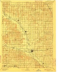
1892 Map of Minneapolis
USGS Topo · Published 1910About this map
The Solomon River meanders across this late 19th-century landscape, serving as a geographic anchor for the early development of north-central Kansas. This 1890 survey illustrates a region meticulously organized by township and section lines, where the expansion of commercial rail networks was actively shaping settlement patterns. The Atchison Topeka and Santa Fe Railroad enters from the northeast through Minneapolis, while the Union Pacific Railway follows the lower southern corridor along the Saline River, connecting towns like Beverly and Tescott. This dual-rail infrastructure highlights the era's transition toward an industrial-agrarian economy. Local hubs such as Delphos, Glasco, and Asherville appear as established community centers amidst a dense network of watercourses, including the complex drainage of Pipe Creek and Salt Creek. The map records the foundational township names, such as Meredith and Garfield, providing a snapshot of political organization before modern consolidation.
Find a feature on this map
61 named features on this map. Tap any name to fly to it.
Don’t see what you’re looking for? This feature index may not catch every label — zoom into the map to look around manually.
Map Details
Editions of this 1892 Minneapolis Map
5 editions found
Other maps of this area

1889 · Abilene
USGS Topo · 1:125,000

1891 · Clay Center
USGS Topo · 1:125,000

1892 · Concordia
USGS Topo · 1:125,000

1892 · Salina
USGS Topo · 1:125,000

1892 · Minneapolis
USGS Topo · 1:125,000

1893 · Washington
USGS Topo · 1:125,000

1894 · Ellsworth
USGS Topo · 1:125,000

1894 · Abilene
USGS Topo · 1:125,000

1894 · Mankato
USGS Topo · 1:125,000

1894 · Beloit
USGS Topo · 1:125,000