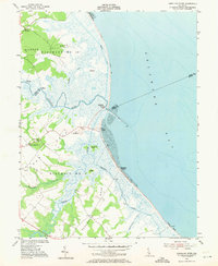
1955 Map of Mispillion River
USGS Topo · Published 1971About this map
Fort Saulsbury stands as a prominent sentinel on this mid-century survey of the Delaware coastline, where the Mispillion River meets the Delaware Bay. The landscape is defined by its low-lying marshes and intricate waterways, including Crooked Gut and Slaughter Creek. Coastal navigation and maritime life are centered around the Mispillion Light (Tower) and several landings such as Maloneys Landing and Cains Landing, which reflect the area's historical reliance on river transport and fishing.
Find a feature on this map
31 named features on this map. Tap any name to fly to it.
Don’t see what you’re looking for? This feature index may not catch every label — zoom into the map to look around manually.
Map Details
Editions of this 1955 Mispillion River Map
3 editions found
Other maps of this area

1890 · Maurice Cove
USGS Topo · 1:62,500

1891 · Maurice Cove
USGS Topo · 1:62,500

1899 · Vineland
USGS Topo · 1:125,000

1918 · Cedar Creek
USGS Topo · 1:62,500

1918 · Cape Henlopen
USGS Topo · 1:62,500

1919 · Cedar Creek
USGS Topo · 1:62,500

1919 · Vineland
USGS Topo · 1:125,000

1934 · Bowers
USGS Topo · 1:48,000
1936 · Bowers
USGS Topo · 1:62,500

1937 · Cape Henlopen
USGS Topo · 1:62,500