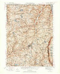
1943 Map of Montrose
USGS Topo · Published 1965About this map
The county seat of Montrose serves as the focal point of this 1943 survey, revealing a landscape of upland ridges and numerous glacial lakes in Susquehanna County. The settlement pattern is characterized by numerous small crossroads and hamlets such as Franklin Forks, St Joseph, and Brookdale. The region's early educational infrastructure is well-documented through a high density of rural schoolhouses, including Mott Sch, Hamlin Sch, and Silver Lake Sch.
Find a feature on this map
101 named features on this map. Tap any name to fly to it.
Don’t see what you’re looking for? This feature index may not catch every label — zoom into the map to look around manually.
Map Details
Editions of this 1943 Montrose Map

Other maps of this area

1892 · Dundaff
USGS Topo · 1:62,500

1901 · Apalachin
USGS Topo · 1:62,500

1904 · Binghamton
USGS Topo · 1:62,500

1904 · Apalachin
USGS Topo · 1:62,500

1905 · Nineveh
USGS Topo · 1:62,500

1906 · Catatonk
USGS Topo · 1:125,000

1932 · Susquehanna
USGS Topo · 1:62,500

1935 · Binghamton West
USGS Topo · 1:24,000

1935 · Susquehanna
USGS Topo · 1:62,500

1937 · Binghamton East
USGS Topo · 1:24,000