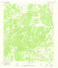
1963 Map of Monument Hill
USGS Topo · Published 1973About this map
Monument Hill and Martin Mountain anchor this central Texas landscape, characterized by a complex drainage system of creeks and spring-fed branches. The topography is defined by the winding course of Miller Creek and its many tributaries, including Towhead Creek and Turkey Creek. While largely a rural ranching and hill country environment in the early 1960s, the map reveals specific human imprints such as a remote Landing Strip and numerous Gravel Pits scattered across the higher elevations.
Find a feature on this map
26 named features on this map. Tap any name to fly to it.
Don’t see what you’re looking for? This feature index may not catch every label — zoom into the map to look around manually.
Map Details
Editions of this 1963 Monument Hill Map
2 editions found
Other maps of this area

1887 · Blanco
USGS Topo · 1:125,000

1894 · Fredericksburg
USGS Topo · 1:125,000

1894 · Blanco
USGS Topo · 1:125,000

1954 · Llano
USGS Topo · 1:250,000

1955 · Llano
USGS Topo · 1:250,000

1956 · Llano
USGS Topo · 1:250,000

1961 · Hye
USGS Topo · 1:24,000

1961 · Rocky Creek
USGS Topo · 1:24,000
1961 · Johnson City
USGS Topo · 1:24,000

1963 · Yeager Creek
USGS Topo · 1:24,000