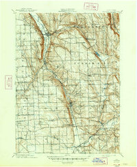
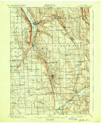
1902 Map of Moravia
USGS Topo · Published 1947About this map
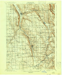
The Lehigh Valley Railroad corridor anchors this turn-of-the-century landscape, following the deep valley of the Owasco Inlet through Moravia and Locke. To the east, the terrain rises sharply toward Lake Como and the high plateaus of Sempronius and Summer Hill. This map reveals a late 19th-century agrarian economy defined by localized water power and small rural clusters, evidenced by sites like Morse Mill in the north and Red Mill further south.
Find a feature on this map
54 named features on this map. Tap any name to fly to it.
Don’t see what you’re looking for? This feature index may not catch every label — zoom into the map to look around manually.
Map Details
Editions of this 1902 Moravia Map
7 editions found
Other maps of this area

1893 · Ithaca
USGS Topo · 1:62,500

1895 · Ithaca
USGS Topo · 1:62,500

1898 · Moravia
USGS Topo · 1:62,500

1899 · Auburn
USGS Topo · 1:62,500

1899 · Skaneateles
USGS Topo · 1:62,500

1900 · Tully
USGS Topo · 1:62,500

1900 · Dryden
USGS Topo · 1:62,500

1902 · Skaneateles
USGS Topo · 1:62,500

1902 · Moravia
USGS Topo · 1:62,500

1902 · Genoa
USGS Topo · 1:62,500