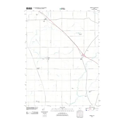
2010 Map of Morral
USGS Topo · Published 2010About this map
The agricultural landscape of Marion County is defined by the winding course of the Little Sandusky River and its various tributaries. Central to the area is the village of Morral, which serves as a local hub with its Morral Post Office and nearby Neff Cemetery. The terrain is generally flat, typical of this region of Ohio, though it is punctuated by Brush Ridge and several notable water bodies, including Edwin Naus Lake and the Little Scioto River. Genealogists will find a high density of burial grounds throughout the township, ranging from the Little Sandusky Cemetery in the north to Chapel Heights Memorial Gardens and Pleasant Hill Cemetery in the south. The survey captures the intersection of rural life and modern development, where family-named roads like Fribley Rd and Hillman Ford Rd crisscross a grid of township and county highways that link the smaller settlements of Little Sandusky and Carpenters Corners.
Find a feature on this map
55 named features on this map. Tap any name to fly to it.
Don’t see what you’re looking for? This feature index may not catch every label — zoom into the map to look around manually.
Map Details
Editions of this 2010 Morral Map
This is the sole edition of this map. No revisions or reprints were ever made.
Other maps of this area

1903 · Marion
USGS Topo · 1:62,500

1905 · Marion
USGS Topo · 1:62,500

1906 · Sycamore
USGS Topo · 1:62,500

1907 · Upper Sandusky
USGS Topo · 1:62,500

1915 · La Rue
USGS Topo · 1:62,500

1950 · Marion
USGS Topo · 1:250,000

1960 · Oceola
USGS Topo · 1:24,000

1960 · Nevada
USGS Topo · 1:24,000
1960 · Morral
USGS Topo · 1:24,000

1960 · Upper Sandusky
USGS Topo · 1:24,000