
1955 Map of Mount Hayes
USGS Topo · Published 1966About this map
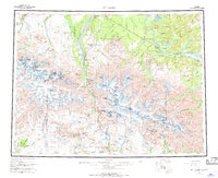
Fort Greely and the upper reaches of the Delta River define this high-altitude Alaskan landscape as it was documented in the mid-1950s. The region is a complex intersection of glacial systems and early transportation corridors, where the Richardson Highway tracks the river valley through high mountain passes. The map captures established outposts like Black Rapids and Donnelly, while further east, the Dot Lake Indian Village sits near the confluence of the Johnson River and the Alaska Highway. The presence of the Denali Mountains and the massive Hayes Glacier provides a clear view of the topographical barriers that shaped early Alaskan settlement and travel routes. From the summit of Mount Hayes to the southern reach of Paxson at the junction of the Denali Highway, the sheet details a landscape where seasonal travel and wilderness accessibility were the primary drivers of human activity.
Find a feature on this map
100 named features on this map. Tap any name to fly to it.
Don’t see what you’re looking for? This feature index may not catch every label — zoom into the map to look around manually.
Map Details
Editions of this 1955 Mount Hayes Map
4 editions found
Other maps of this area

1948 · Tanacross A-6
USGS Topo · 1:63,360

1949 · Tanacross
USGS Topo · 1:250,000

1949 · Mount Hayes A-4
USGS Topo · 1:63,360

1949 · Gulkana D-3
USGS Topo · 1:63,360

1949 · Nabesna D-6
USGS Topo · 1:63,360

1949 · Big Delta A-6
USGS Topo · 1:63,360

1949 · Tanacross B-6
USGS Topo · 1:63,360

1949 · Fairbanks A-1
USGS Topo · 1:63,360

1949 · Healy A-1
USGS Topo · 1:63,360

1949 · Healy D-1
USGS Topo · 1:63,360