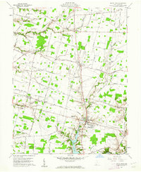
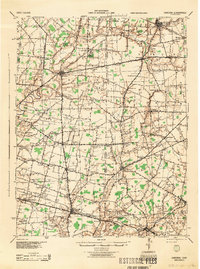
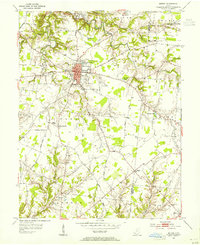
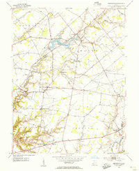
1960 Map of Mount Orab
USGS Topo · Published 1962About this map
The village of Mount Orab serves as the focal point of this Brown County landscape, where the Norfolk and Western railroad corridor bisects the town's residential grid. This 1960s survey illustrates a rural Ohio community balanced between agricultural land and local civic landmarks, including the Mt Orab High Sch and several Grain Storage Bins. The surrounding countryside is dotted with small, crossroads settlements like Stringtown, Centerville, and Greenbush, each anchored by historical institutions such as the Union Plains Ch and Green-Sterling Sch.
Find a feature on this map
60 named features on this map. Tap any name to fly to it.
Don’t see what you’re looking for? This feature index may not catch every label — zoom into the map to look around manually.
Map Details
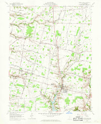
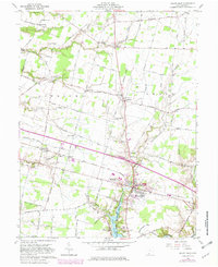
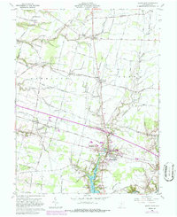
Editions of this 1960 Mount Orab Map
4 editions found
Other maps of this area

1914 · Batavia
USGS Topo · 1:48,000

1916 · Batavia
USGS Topo · 1:62,500

1917 · Sardinia
USGS Topo · 1:62,500

1928 · Higginsport
USGS Topo · 1:48,000

1931 · Felicity
USGS Topo · 1:62,500

1931 · Higginsport
USGS Topo · 1:62,500
1944 · Sardinia
USGS Topo · 1:62,500

1947 · Columbus
USGS Topo · 1:250,000
1953 · Bethel
USGS Topo · 1:24,000
1953 · Newtonsville
USGS Topo · 1:24,000