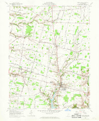
1960 Map of Mount Orab
USGS Topo · Published 1970About this map
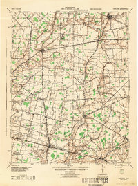
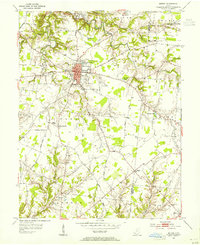
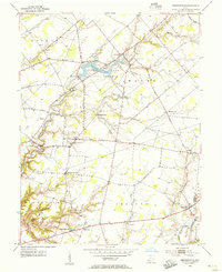
The village of Mount Orab serves as the focal point of this 1960 survey of Brown County, Ohio, situated at the intersection of local commerce and transportation. The Norfolk and Western railway cuts through the center of the township, while the newly created waters of Lake Grant define the southern landscape. The map details a transition from the compact grid of the village, featuring the Orpheum Theater and Mt Orab High Sch, to the broader agricultural lands of Sterling and Pike townships. This agrarian character is emphasized by numerous rural community centers such as Centerville, Greenbush, and Bardwell. Local heritage is preserved through a network of country churches and burial grounds, including Burdall Chapel, Taylors Chapel Cem, and Star Lake Cem, reflecting the early settlement patterns within the Virginia Military District.
Find a feature on this map
77 named features on this map. Tap any name to fly to it.
Don’t see what you’re looking for? This feature index may not catch every label — zoom into the map to look around manually.
Map Details
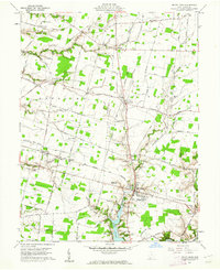
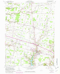
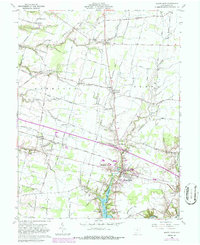
Editions of this 1960 Mount Orab Map
4 editions found
Other maps of this area

1914 · Batavia
USGS Topo · 1:48,000

1916 · Batavia
USGS Topo · 1:62,500

1917 · Sardinia
USGS Topo · 1:62,500

1928 · Higginsport
USGS Topo · 1:48,000

1931 · Felicity
USGS Topo · 1:62,500

1931 · Higginsport
USGS Topo · 1:62,500
1944 · Sardinia
USGS Topo · 1:62,500

1947 · Columbus
USGS Topo · 1:250,000
1953 · Bethel
USGS Topo · 1:24,000
1953 · Newtonsville
USGS Topo · 1:24,000