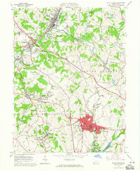
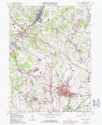
1964 Map of Mount Pleasant
USGS Topo · Published 1965About this map
Industrial and coal-patch history defines this Westmoreland County landscape, where the Pennsylvania Railroad and Baltimore and Ohio Railroad once serviced numerous mining operations and manufacturing hubs. The urban center of Mount Pleasant is depicted in detail, featuring landmarks like Ramsay High School and the local Hospital. Radiating outward from the borough are the distinctive residential and industrial patterns of settlements like Hecla, Carpentertown, and Morewood. Evidence of the region’s carbon-based economy is visible in the Coke Ovens near Alverton and the Standard Shaft north of the borough. Small rural communities such as Rufis Dale, Rocktown, and Tarrs are connected by a network of local roads that weave between deep hollows like Simpson Hollow and Leighty Hollow. These features, along with numerous local cemeteries including the Polish Cemetery and Sewickley Cemetery, provide a detailed record of mid-century life in the coal fields.
Find a feature on this map
82 named features on this map. Tap any name to fly to it.
Don’t see what you’re looking for? This feature index may not catch every label — zoom into the map to look around manually.
Map Details
Editions of this 1964 Mount Pleasant Map
5 editions found
Other maps of this area

1900 · Latrobe
USGS Topo · 1:62,500

1902 · Latrobe
USGS Topo · 1:62,500

1902 · Connellsville
USGS Topo · 1:62,500

1903 · Latrobe
USGS Topo · 1:62,500

1904 · Greensburg
USGS Topo · 1:62,500

1906 · Greensburg
USGS Topo · 1:62,500

1922 · Donegal
USGS Topo · 1:62,500

1931 · Connellsville
USGS Topo · 1:62,500

1935 · Donegal
USGS Topo · 1:62,500

1936 · Connellsville
USGS Topo · 1:62,500