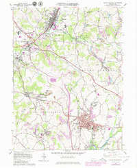
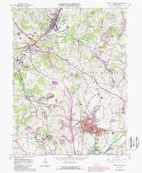
1964 Map of Mount Pleasant
USGS Topo · Published 1980About this map
Industrial and coal-mining history define the Westmoreland County landscape, where the borough of Mount Pleasant serves as a central hub. The terrain is marked by an extensive network of Strip Mines and historical infrastructure, including Coke Ovens and the Standard Shaft. Significant transport corridors like the Pennsylvania Turnpike and the Conrail lines intersect smaller coal settlements such as Morewood, Tarrs, and United.
Find a feature on this map
94 named features on this map. Tap any name to fly to it.
Don’t see what you’re looking for? This feature index may not catch every label — zoom into the map to look around manually.
Map Details
Editions of this 1964 Mount Pleasant Map
5 editions found
Other maps of this area

1900 · Latrobe
USGS Topo · 1:62,500

1902 · Latrobe
USGS Topo · 1:62,500

1902 · Connellsville
USGS Topo · 1:62,500

1903 · Latrobe
USGS Topo · 1:62,500

1904 · Greensburg
USGS Topo · 1:62,500

1906 · Greensburg
USGS Topo · 1:62,500

1922 · Donegal
USGS Topo · 1:62,500

1931 · Connellsville
USGS Topo · 1:62,500

1935 · Donegal
USGS Topo · 1:62,500

1936 · Connellsville
USGS Topo · 1:62,500