
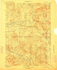
1902 Map of Mt Leidy
USGS Topo · Published 1902About this map
The Continental Divide zigzags across this high-elevation landscape, forming the spine between the Wind River and the extensive watershed of the Buffalo Fork. Surveyed in 1899, this area within the Teton Forest Reserve and the Yellowstone Park Forest Reserve is defined by its complex drainage systems and prominent peaks like Mt. Leidy and Lava Mt.. The map documents early mountain transit points such as Twogwotee Pass and Bear Cub Pass, while the lower elevations feature named clearings like Dick Turpin Meadow and Blackrock Meadows.
Find a feature on this map
62 named features on this map. Tap any name to fly to it.
Don’t see what you’re looking for? This feature index may not catch every label — zoom into the map to look around manually.
Map Details
Editions of this 1902 Mt Leidy Map
5 editions found
Other maps of this area

1885 · Lake
USGS Topo · 1:125,000

1886 · Shoshone
USGS Topo · 1:125,000

1888 · Shoshone
USGS Topo · 1:125,000

1893 · Ishawooa
USGS Topo · 1:125,000

1895 · Shoshone
USGS Topo · 1:125,000

1895 · Ishawooa
USGS Topo · 1:125,000

1895 · Lake
USGS Topo · 1:125,000

1896 · Lake
USGS Topo · 1:125,000

1899 · Ishawooa
USGS Topo · 1:125,000

1899 · Grand Teton
USGS Topo · 1:125,000