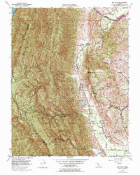
1951 Map of Mt. Vaca
USGS Topo · Published 1969About this map
Pleasants Valley Road serves as the primary north-south artery through this section of the Vaca Mountains, connecting rural outposts and family-held land in the mid-20th century. The topography is defined by the sharp rise of Blue Ridge and Pleasants Ridge, which separate the rugged interior canyons from the lower English Hills. Within these folds, the map documents the transition of local education, showing the Pleasants Valley School and Oakdale Sch alongside the Rhine School (Abandoned) in Mix Canyon. Water management is central to the area's geography, with Putah Creek and the Rio de los Putos cutting through the northern valleys while a portion of Lake Berryessa appears at the western edge. Small settlements and working landscapes like Bucktown and the Pioneer Ranch anchor the community at the base of Mt Vaca.
Find a feature on this map
34 named features on this map. Tap any name to fly to it.
Don’t see what you’re looking for? This feature index may not catch every label — zoom into the map to look around manually.
Map Details
Editions of this 1951 Mt. Vaca Map
3 editions found
Other maps of this area

1902 · Napa
USGS Topo · 1:125,000

1907 · Woodland
USGS Topo · 1:62,500

1908 · Vacaville
USGS Topo · 1:62,500

1916 · Winters
USGS Topo · 1:31,680

1917 · Wolfskill
USGS Topo · 1:31,680

1917 · Elmira
USGS Topo · 1:31,680

1921 · Mt. Vaca
USGS Topo · 1:62,500

1924 · Capay
USGS Topo · 1:62,500
1941 · Vacaville
USGS Topo · 1:62,500
1941 · Woodland
USGS Topo · 1:62,500