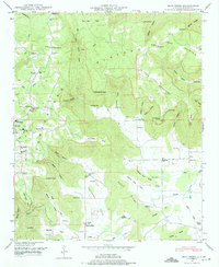
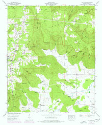
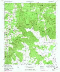
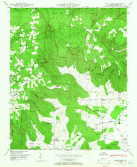
1948 Map of Mud Creek
USGS Topo · Published 1975About this map
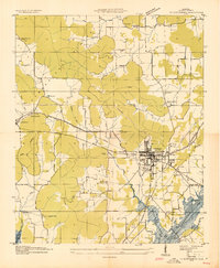
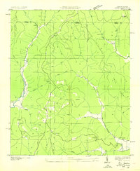
Cumberland Plateau terrain defines this region of Jackson County, where the Tennessee Valley Authority and USGS documented a landscape of deep hollows and sharp points in the late 1940s. The settlement at Cornelison and the community surrounding Holland Chapel are connected by a network of rural roads that navigate around dramatic features like The Buzzard Roost and Gizzard Point. The map reveals a dense concentration of local institutions, from Skyline Ch and Fairfield Church to Kyles Sch No 1 and Tupelo Sch, reflecting a well-established social fabric in these valleys. Water sources like Robinson Spring and Bucker Pond provide vital landmarks among the ridges, while numerous family cemeteries, such as Sanders Cem and Dolberry Cem, offer significant clues for genealogical research. The varied topography, from the heights of Crow Mountain to the depths of Peacock Hollow, illustrates the complex geography of north Alabama's plateau country.
Find a feature on this map
97 named features on this map. Tap any name to fly to it.
Don’t see what you’re looking for? This feature index may not catch every label — zoom into the map to look around manually.
Map Details
Editions of this 1948 Mud Creek Map
5 editions found

Other maps of this area

1886 · Stevenson
USGS Topo · 1:125,000

1888 · Scottsboro
USGS Topo · 1:125,000

1892 · Scottsboro
USGS Topo · 1:125,000

1892 · Stevenson
USGS Topo · 1:125,000

1895 · Stevenson
USGS Topo · 1:125,000
1936 · Scottsboro
USGS Topo · 1:24,000

1936 · Wannville
USGS Topo · 1:24,000

1936 · Mud Creek
USGS Topo · 1:24,000
1936 · Hytop
USGS Topo · 1:24,000

1936 · Princeton
USGS Topo · 1:24,000