1948 Map of Mud Creek
USGS Topo · Published 1982About this map
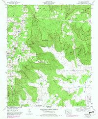
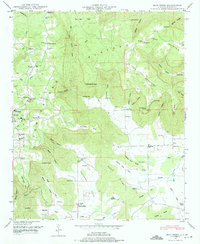
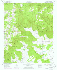
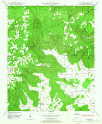
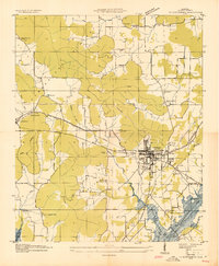
Cumberland Plateau terrain dominates this Jackson County landscape, where deep hollows and high points like The Buzzard Roost define the 1940s settlement patterns. The community of Skyline serves as a local hub, featuring the Skyline Sch and Skyline Ch. Genealogical interest is high throughout the quadrangle, which is dotted with family burial grounds such as Sanders Cem, Dolberry Cem, and Proctor Cem.
Find a feature on this map
75 named features on this map. Tap any name to fly to it.
Don’t see what you’re looking for? This feature index may not catch every label — zoom into the map to look around manually.
Map Details
Editions of this 1948 Mud Creek Map
5 editions found

Other maps of this area

1886 · Stevenson
USGS Topo · 1:125,000

1888 · Scottsboro
USGS Topo · 1:125,000

1892 · Scottsboro
USGS Topo · 1:125,000

1892 · Stevenson
USGS Topo · 1:125,000

1895 · Stevenson
USGS Topo · 1:125,000
1936 · Scottsboro
USGS Topo · 1:24,000

1936 · Wannville
USGS Topo · 1:24,000

1936 · Mud Creek
USGS Topo · 1:24,000
1936 · Hytop
USGS Topo · 1:24,000

1936 · Princeton
USGS Topo · 1:24,000