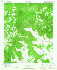
1948 Map of Mud Creek
USGS Topo · Published 1986About this map
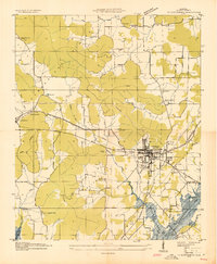
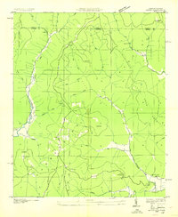
The Cumberland Plateau dominates the high ground of this corner of Jackson County, where the transition from flat mountaintops like Post Oak Flat to deep coves defines the local geography. In the late 1940s, life in this region centered on scattered rural settlements like Skyline Ch and Tupelo, connected by winding roads through Maynard Cove and Round Cove. The map reveals a high density of small family and community cemeteries, including Sanders Cem, Moody Cem, and Proctor Cem, which are essential for tracing local family lineages.
Find a feature on this map
89 named features on this map. Tap any name to fly to it.
Don’t see what you’re looking for? This feature index may not catch every label — zoom into the map to look around manually.
Map Details
Editions of this 1948 Mud Creek Map
5 editions found
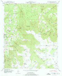
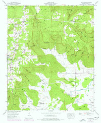
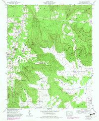

Other maps of this area

1886 · Stevenson
USGS Topo · 1:125,000

1888 · Scottsboro
USGS Topo · 1:125,000

1892 · Scottsboro
USGS Topo · 1:125,000

1892 · Stevenson
USGS Topo · 1:125,000

1895 · Stevenson
USGS Topo · 1:125,000
1936 · Scottsboro
USGS Topo · 1:24,000

1936 · Wannville
USGS Topo · 1:24,000

1936 · Mud Creek
USGS Topo · 1:24,000
1936 · Hytop
USGS Topo · 1:24,000

1936 · Princeton
USGS Topo · 1:24,000