
1953 Map of Muncie
USGS Topo · Published 1966About this map
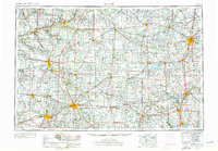
Muncie and the industrial corridors of east-central Indiana and western Ohio appear here at the mid-century peak of the rail era. The map details a dense network of major carriers including the Pennsylvania and Norfolk and Western railroads, which linked manufacturing hubs like Anderson, Marion, and Lima. This region, characterized by its grid of small farming communities and county seats, is bisected by the Indiana-Ohio state line and drained by a complex system of waterways including the Wabash River, White River, and Mississinewa River.
Find a feature on this map
95 named features on this map. Tap any name to fly to it.
Don’t see what you’re looking for? This feature index may not catch every label — zoom into the map to look around manually.
Map Details
Editions of this 1953 Muncie Map
5 editions found
Other maps of this area

1904 · Springfield
USGS Topo · 1:62,500

1904 · Dayton
USGS Topo · 1:62,500

1905 · Brookville
USGS Topo · 1:62,500

1906 · Dayton
USGS Topo · 1:62,500

1906 · Springfield
USGS Topo · 1:62,500

1906 · Lima
USGS Topo · 1:62,500

1906 · Columbus Grove
USGS Topo · 1:62,500

1907 · Bluffton
USGS Topo · 1:62,500

1908 · Columbus Grove
USGS Topo · 1:62,500

1908 · Ottawa
USGS Topo · 1:62,500