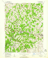
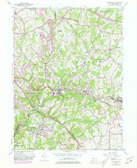
1953 Map of Murrysville
USGS Topo · Published 1960About this map
Industrial energy and suburban growth converge in this mid-century portrait of Murrysville and the surrounding townships of Plum and Franklin. The landscape is heavily marked by the region's extraction history, featuring numerous Gas Wells and active Strip Mines that dot the hillsides near Export. These industrial sites are punctuated by specialized infrastructure like the Dice Pumping Sta and the Sloan Pumping Sta, which supported the area's gas and oil production.
Find a feature on this map
58 named features on this map. Tap any name to fly to it.
Don’t see what you’re looking for? This feature index may not catch every label — zoom into the map to look around manually.
Map Details
Editions of this 1953 Murrysville Map
5 editions found
Other maps of this area

1904 · Mc Keesport
USGS Topo · 1:62,500

1904 · Greensburg
USGS Topo · 1:62,500

1906 · Greensburg
USGS Topo · 1:62,500

1907 · Pittsburg
USGS Topo · 1:62,500

1907 · Freeport
USGS Topo · 1:62,500

1908 · New Kensington
USGS Topo · 1:62,500

1909 · Freeport
USGS Topo · 1:62,500

1910 · New Kensington
USGS Topo · 1:62,500

1953 · Pittsburgh
USGS Topo · 1:250,000
1953 · Mc Keesport
USGS Topo · 1:24,000