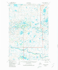
1952 Map of Naknek B-3
USGS Topo · Published 1980About this map
The King Salmon River winds through this expanse of southwestern Alaska, providing a vital waterway within a landscape defined by wetlands and high-altitude lakes. Surveyed in the early 1950s, the map highlights the intersection of two significant conservation areas: Katmai National Monument to the northeast and Becharof National Monument along the southern and eastern margins. The topography is predominantly characterized by low-relief marshlands and numerous unnamed ponds, reflecting the glacial legacy of the Alaska Peninsula. A single Cabin label is the only indication of permanent man-made shelter in this wilderness, suggesting a landscape used primarily for seasonal subsistence or early field research rather than established settlement. The drainage patterns and topographic contours captured here offer a baseline for studying the shifting hydrology of this protected region before the modern era of environmental monitoring.
Find a feature on this map
4 named features on this map. Tap any name to fly to it.
Don’t see what you’re looking for? This feature index may not catch every label — zoom into the map to look around manually.
Map Details
Editions of this 1952 Naknek B-3 Map
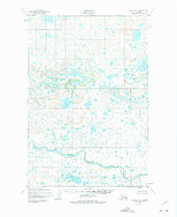
Other maps of this area

1951 · Naknek A-2
USGS Topo · 1:63,360

1951 · Naknek A-4
USGS Topo · 1:63,360

1951 · Naknek A-3
USGS Topo · 1:63,360

1952 · Naknek
USGS Topo · 1:250,000

1952 · Naknek B-3
USGS Topo · 1:63,360

1952 · Naknek B-4
USGS Topo · 1:63,360

1952 · Naknek B-2
USGS Topo · 1:63,360

1952 · Naknek C-2
USGS Topo · 1:63,360

1952 · Naknek C-3
USGS Topo · 1:63,360

1952 · Naknek C-4
USGS Topo · 1:63,360