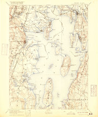
1892 Map of Narragansett Bay
USGS Topo · Published 1918About this map
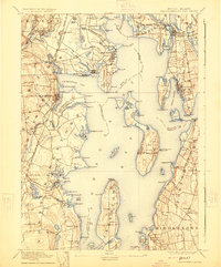
Narragansett Bay serves as the central focal point of this late 19th-century coastal survey, revealing a landscape defined by its intricate shoreline and maritime infrastructure. The map details the transition between industrial centers and agricultural estates, notably featuring the State Prison and State Farm in Cranston. Extensive rail networks, such as the New York Providence and Boston R.R., connect coastal villages like Wickford and East Greenwich to the interior, highlighting the era's reliance on steam transport.
Find a feature on this map
164 named features on this map. Tap any name to fly to it.
Don’t see what you’re looking for? This feature index may not catch every label — zoom into the map to look around manually.
Map Details
Editions of this 1892 Narragansett Bay Map
8 editions found

Other maps of this area

1885 · Sakonnet
USGS Topo · 1:62,500

1885 · Taunton
USGS Topo · 1:62,500

1887 · Providence
USGS Topo · 1:62,500

1888 · Fall River
USGS Topo · 1:62,500

1888 · Taunton
USGS Topo · 1:62,500

1888 · Sakonnet
USGS Topo · 1:62,500

1889 · Charlestown
USGS Topo · 1:62,500

1889 · Providence
USGS Topo · 1:62,500

1889 · Newport
USGS Topo · 1:62,500

1889 · Burrillville
USGS Topo · 1:62,500