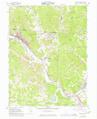
1961 Map of Nelsonville
USGS Topo · Published 1977About this map
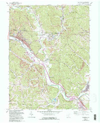
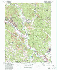
The Hocking River valley south of Nelsonville serves as the industrial and logistical spine for this portion of the Ohio coalfields. Extensive extraction operations, marked by numerous Strip Mines and a Tipple, dominate the terrain from Carbon Hill down to Chauncey. The landscape is a network of small mining settlements like Buchtel, Monday, and Doanville, many of which developed around the Chesapeake and Ohio railroad lines that follow the creek hollows. Evidence of early industry and community life is found in the Brick Kilns near the city center and various rural institutions such as the Township School and Pilgrims Rest Ch. The southeastern corner near The Plains reveals an Indian Mound, suggesting a much deeper history of habitation along the river terrace preceding the 1960s industrial expansion.
Find a feature on this map
74 named features on this map. Tap any name to fly to it.
Don’t see what you’re looking for? This feature index may not catch every label — zoom into the map to look around manually.
Map Details
Editions of this 1961 Nelsonville Map
7 editions found
Other maps of this area

1903 · Athens
USGS Topo · 1:62,500

1904 · Zaleski
USGS Topo · 1:62,500

1905 · Athens
USGS Topo · 1:62,500

1907 · Zaleski
USGS Topo · 1:62,500

1907 · Logan
USGS Topo · 1:62,500

1909 · Logan
USGS Topo · 1:62,500

1911 · New Lexington
USGS Topo · 1:62,500

1947 · Columbus
USGS Topo · 1:250,000

1961 · Columbus
USGS Topo · 1:250,000

1961 · Nelsonville
USGS Topo · 1:24,000