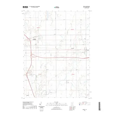
2019 Map of Nevada
USGS Topo · Published 2019About this map
Broken Sword Creek and the Sandusky River dominate this portion of Wyandot County, shaping the settlement patterns around Nevada and Upper Sandusky. The landscape is a characteristic agricultural grid, defined by numerous family-named burial grounds and small waterways such as Cranberry Run and Porcupine Cr. This 2019 survey documents a deeply rooted rural infrastructure where nineteenth-century landmarks like Swartz Bridge and Emanuel Cem persist alongside modern transportation corridors. The high density of cemeteries, including Ulrich Cem, Salem Cem, and Gilliland Cem, provides a detailed record of early families in the T2S and T3S townships. The smaller communities of Edenville and Harpster serve as quiet anchors in a territory primarily defined by its drainage basins, from Gray Eye Run to the aptly named Rock Run.
Find a feature on this map
53 named features on this map. Tap any name to fly to it.
Don’t see what you’re looking for? This feature index may not catch every label — zoom into the map to look around manually.
Map Details
Editions of this 2019 Nevada Map
This is the sole edition of this map. No revisions or reprints were ever made.
Other maps of this area

1903 · Marion
USGS Topo · 1:62,500

1905 · Marion
USGS Topo · 1:62,500

1906 · Sycamore
USGS Topo · 1:62,500

1907 · Upper Sandusky
USGS Topo · 1:62,500

1915 · La Rue
USGS Topo · 1:62,500

1950 · Marion
USGS Topo · 1:250,000

1960 · Sycamore
USGS Topo · 1:24,000

1960 · Oceola
USGS Topo · 1:24,000
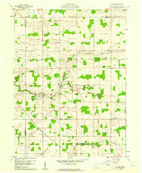
1960 · Lykens
USGS Topo · 1:24,000

1960 · Nevada
USGS Topo · 1:24,000