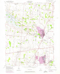
1955 Map of New Carlisle
USGS Topo · Published 1974About this map
New Carlisle serves as the primary hub of this landscape, situated at the intersection of early routes like the New Carlisle Pike and the Penn Central railroad. The map documents a period of suburban expansion, with later 1960s and 70s residential growth highlighted in purple around the established cores of New Carlisle and the lakefront community at Crystal Lakes. These newer developments contrast with the traditional rural layout of Bethel Township, where numerous family cemeteries like Winters Cem and Saylor Cem are located near local landmarks such as the Elizabeth Township Central Sch.
Find a feature on this map
67 named features on this map. Tap any name to fly to it.
Don’t see what you’re looking for? This feature index may not catch every label — zoom into the map to look around manually.
Map Details
Editions of this 1955 New Carlisle Map
4 editions found
Other maps of this area

1904 · Springfield
USGS Topo · 1:62,500

1904 · Dayton
USGS Topo · 1:62,500

1906 · Dayton
USGS Topo · 1:62,500

1906 · Springfield
USGS Topo · 1:62,500

1914 · Troy
USGS Topo · 1:62,500

1914 · St. Paris
USGS Topo · 1:62,500

1916 · St. Paris
USGS Topo · 1:62,500

1944 · St. Paris
USGS Topo · 1:62,500

1944 · Troy
USGS Topo · 1:62,500

1947 · Columbus
USGS Topo · 1:250,000