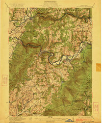
1922 Map of New Florence
USGS Topo · Published 1922About this map
The Conemaugh River carves a deep path through the industrial and rural landscapes of Westmoreland and Indiana counties, serving as a primary corridor for the Pennsylvania R R. Along its banks, small railroad and mining settlements like Lockport Station, Robinson, and Bolivar illustrate the early 20th-century dependence on rail transport and resource extraction. The map captures an era when rural life was anchored by local institutions, evidenced by the high density of country schools such as Factory School, Trindle School, and Mahan School.
Find a feature on this map
113 named features on this map. Tap any name to fly to it.
Don’t see what you’re looking for? This feature index may not catch every label — zoom into the map to look around manually.
Map Details
Editions of this 1922 New Florence Map
5 editions found

Other maps of this area

1900 · Latrobe
USGS Topo · 1:62,500

1902 · Latrobe
USGS Topo · 1:62,500

1902 · Indiana
USGS Topo · 1:62,500

1902 · Barnesboro
USGS Topo · 1:62,500

1902 · Elders Ridge
USGS Topo · 1:62,500

1903 · Latrobe
USGS Topo · 1:62,500

1904 · Barnesboro
USGS Topo · 1:62,500

1904 · Elders Ridge
USGS Topo · 1:62,500

1904 · Johnstown
USGS Topo · 1:62,500

1907 · Johnstown
USGS Topo · 1:62,500