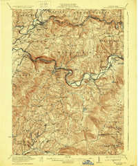
1922 Map of New Florence
USGS Topo · Published 1929About this map
The Conemaugh River snakes through deep gaps in the Chestnut Ridge and Laurel Ridge, defining the industrial and geographic character of this Pennsylvania region during the early 1920s. This survey captures a dense network of mountain settlements and transportation hubs where the Pennsylvania railroad follows the river's winding course. Notable junctions and post offices like Blairsville Intersection Torrance P O, Lockport Station, and Centerville Huff P O serve as focal points for local commerce and travel.
Find a feature on this map
103 named features on this map. Tap any name to fly to it.
Don’t see what you’re looking for? This feature index may not catch every label — zoom into the map to look around manually.
Map Details
Editions of this 1922 New Florence Map
5 editions found

Other maps of this area

1900 · Latrobe
USGS Topo · 1:62,500

1902 · Latrobe
USGS Topo · 1:62,500

1902 · Indiana
USGS Topo · 1:62,500

1902 · Barnesboro
USGS Topo · 1:62,500

1902 · Elders Ridge
USGS Topo · 1:62,500

1903 · Latrobe
USGS Topo · 1:62,500

1904 · Barnesboro
USGS Topo · 1:62,500

1904 · Elders Ridge
USGS Topo · 1:62,500

1904 · Johnstown
USGS Topo · 1:62,500

1907 · Johnstown
USGS Topo · 1:62,500