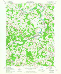
1957 Map of New Galilee
USGS Topo · Published 1968About this map
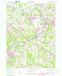
Little Beaver River and its numerous tributaries carve through this corner of Beaver and Lawrence Counties, defining a landscape of active industry and small-town commerce. The valley floor is marked by extensive coal mining operations, with numerous strip mines dotting the hillsides around Enon Valley and Cannelton. The Pennsylvania and Southern railroads serve as the primary transit corridors, connecting the industrial hubs of New Galilee and Darlington. Grounded insights into mid-century local life are visible in landmarks like the Drive-in Theater near Big Beaver and the Brick Kilns that point to the region's manufacturing roots. Local genealogy is well-supported by the presence of the Little Beaver Cem, Wilson Cem, and the White Ch, reflecting the deep-seated community centers of the rural townships.
Find a feature on this map
43 named features on this map. Tap any name to fly to it.
Don’t see what you’re looking for? This feature index may not catch every label — zoom into the map to look around manually.
Map Details
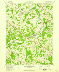
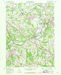
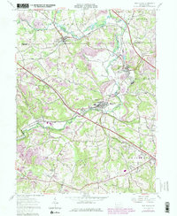
Editions of this 1957 New Galilee Map
5 editions found
Other maps of this area

1901 · Beaver
USGS Topo · 1:62,500

1902 · New Castle
USGS Topo · 1:62,500

1904 · Newcastle
USGS Topo · 1:62,500

1904 · Wellsville
USGS Topo · 1:62,500

1904 · Beaver
USGS Topo · 1:62,500

1907 · Columbiana
USGS Topo · 1:62,500

1909 · Columbiana
USGS Topo · 1:62,500

1937 · Wellsville
USGS Topo · 1:62,500

1944 · Wellsville
USGS Topo · 1:62,500

1951 · Canton
USGS Topo · 1:250,000