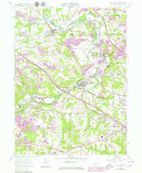
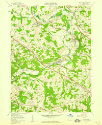
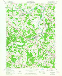
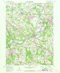
1957 Map of New Galilee
USGS Topo · Published 1979About this map
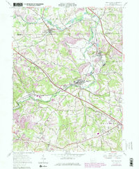
New Galilee and Darlington anchor this topographic record of western Beaver County, where the industrial and agrarian histories of Pennsylvania converge. The landscape is defined by the winding course of Little Beaver Creek and its many tributaries, such as Madden Run and Dilworth Run. The mapping reveals a complex infrastructure of transport and industry, from the heavy-duty transit of the Pennsylvania Turnpike and Conrail lines to localized operations like the Brick Kilns near Darlington and scattered Strip Mine sites.
Find a feature on this map
44 named features on this map. Tap any name to fly to it.
Don’t see what you’re looking for? This feature index may not catch every label — zoom into the map to look around manually.
Map Details
Editions of this 1957 New Galilee Map
5 editions found
Other maps of this area

1901 · Beaver
USGS Topo · 1:62,500

1902 · New Castle
USGS Topo · 1:62,500

1904 · Newcastle
USGS Topo · 1:62,500

1904 · Wellsville
USGS Topo · 1:62,500

1904 · Beaver
USGS Topo · 1:62,500

1907 · Columbiana
USGS Topo · 1:62,500

1909 · Columbiana
USGS Topo · 1:62,500

1937 · Wellsville
USGS Topo · 1:62,500

1944 · Wellsville
USGS Topo · 1:62,500

1951 · Canton
USGS Topo · 1:250,000