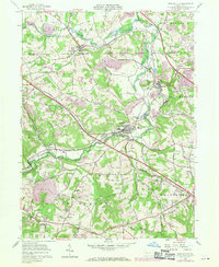
1957 Map of New Galilee
USGS Topo · Published 1970About this map
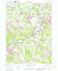
Little Beaver Creek and its complex tributaries carve through the rolling hills of Beaver and Lawrence counties, defining a landscape marked by industrial activity and early settlement patterns. This 1957 survey, updated with 1969 photorevisions, highlights the importance of the Penn Central rail corridor connecting Enon Valley and New Galilee. The economy of the era is clearly visible through numerous strip mines, oil wells, and brick kilns situated near Darlington.
Find a feature on this map
44 named features on this map. Tap any name to fly to it.
Don’t see what you’re looking for? This feature index may not catch every label — zoom into the map to look around manually.
Map Details
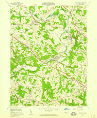
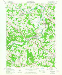
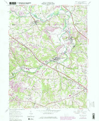
Editions of this 1957 New Galilee Map
5 editions found
Other maps of this area

1901 · Beaver
USGS Topo · 1:62,500

1902 · New Castle
USGS Topo · 1:62,500

1904 · Newcastle
USGS Topo · 1:62,500

1904 · Wellsville
USGS Topo · 1:62,500

1904 · Beaver
USGS Topo · 1:62,500

1907 · Columbiana
USGS Topo · 1:62,500

1909 · Columbiana
USGS Topo · 1:62,500

1937 · Wellsville
USGS Topo · 1:62,500

1944 · Wellsville
USGS Topo · 1:62,500

1951 · Canton
USGS Topo · 1:250,000