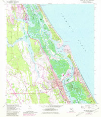
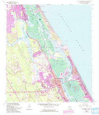
1956 Map of New Smyrna Beach
USGS Topo · Published 1981About this map
New Smyrna Beach serves as the focal point of this coastal survey, where the Florida East Coast railway corridor dictates the layout of the town's inland neighborhoods. The map illustrates a complex maritime landscape where the Intracoastal Waterway threads through the Halifax and Indian River, separated from the Atlantic by a narrow barrier island. Of particular interest to local historians is the depiction of Chisolm High Sch and several smaller settlements like Isleboro and Mission City, which provide a detailed look at mid-century community development. The 1970s-era updates in purple reveal significant suburban expansion around the New Smyrna Beach Municipal Airport and south toward Edgewater, while the natural hydrography remains dominated by a network of tidal passages such as Spruce Creek and the Redland Canal.
Find a feature on this map
67 named features on this map. Tap any name to fly to it.
Don’t see what you’re looking for? This feature index may not catch every label — zoom into the map to look around manually.
Map Details
Editions of this 1956 New Smyrna Beach Map
6 editions found

Other maps of this area

1937 · Port Orange
USGS Topo · 1:48,000

1943 · Port Orange
USGS Topo · 1:62,500

1944 · Port Orange
USGS Topo · 1:62,500

1950 · Ariel
USGS Topo · 1:24,000

1950 · Edgewater
USGS Topo · 1:24,000

1952 · Samsula
USGS Topo · 1:24,000

1952 · Daytona Beach
USGS Topo · 1:24,000

1954 · Daytona Beach
USGS Topo · 1:250,000

1955 · Orlando
USGS Topo · 1:250,000

1956 · Port Orange
USGS Topo · 1:24,000