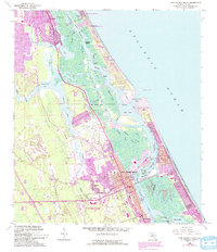
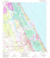
1956 Map of New Smyrna Beach
USGS Topo · Published 1993About this map
New Smyrna Sugar Mill Ruins State Historic Site and the Green Mound State Archaeological Site anchor the deep historical geography of this coastal corridor during the mid-20th century. The landscape is defined by a complex network of salt marshes, mangrove islands, and tidal channels including the Halifax River and North River. Urban expansion is evident in the growth of New Smyrna Beach and Edgewater, while the New Smyrna Beach Municipal Airport and the dredge-cut Intracoastal Waterway signal the era's infrastructure development. Smaller communities like Mission City, Allandale, and Isleboro dot the mainland side of the lagoons, separated from the Atlantic by barrier islands and the volatile Ponce de Leon Inlet. The map details the transition from natural wetlands to residential developments like Sugar Mill Estates, alongside established local landmarks such as Chisholm Sch and the regional Hospital.
Find a feature on this map
64 named features on this map. Tap any name to fly to it.
Don’t see what you’re looking for? This feature index may not catch every label — zoom into the map to look around manually.
Map Details
Editions of this 1956 New Smyrna Beach Map
6 editions found

Other maps of this area

1937 · Port Orange
USGS Topo · 1:48,000

1943 · Port Orange
USGS Topo · 1:62,500

1944 · Port Orange
USGS Topo · 1:62,500

1950 · Ariel
USGS Topo · 1:24,000

1950 · Edgewater
USGS Topo · 1:24,000

1952 · Samsula
USGS Topo · 1:24,000

1952 · Daytona Beach
USGS Topo · 1:24,000

1954 · Daytona Beach
USGS Topo · 1:250,000

1955 · Orlando
USGS Topo · 1:250,000

1956 · Port Orange
USGS Topo · 1:24,000