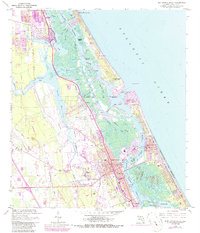
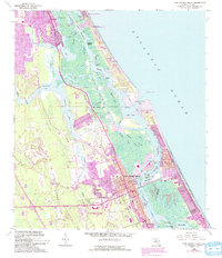
1956 Map of New Smyrna Beach
USGS Topo · Published 1986About this map
New Smyrna Beach and its intricate surrounding waterways define this mid-century coastal landscape, recorded during a period of steady expansion between the 1950s and the late 1970s. The map illustrates a complex network of coastal inlets and cuts, such as Chicken Island Cut and Sheephead Cut, which support the local maritime economy. The historical Florida East Coast railway runs parallel to the coast, anchoring settlements like Isleboro and Mission City. On the northern barrier island, the presence of the Ponce Inlet Lighthouse and the U S Coast Guard Reservation Lighthouse marks the vital entrance to the Halifax River. Local educational and civic life is anchored by landmarks like Chisolm High Sch and the New Smyrna Beach Municipal Airport, while the southern reaches show the early residential footprints of Edgewater.
Find a feature on this map
61 named features on this map. Tap any name to fly to it.
Don’t see what you’re looking for? This feature index may not catch every label — zoom into the map to look around manually.
Map Details
Editions of this 1956 New Smyrna Beach Map
6 editions found

Other maps of this area

1937 · Port Orange
USGS Topo · 1:48,000

1943 · Port Orange
USGS Topo · 1:62,500

1944 · Port Orange
USGS Topo · 1:62,500

1950 · Ariel
USGS Topo · 1:24,000

1950 · Edgewater
USGS Topo · 1:24,000

1952 · Samsula
USGS Topo · 1:24,000

1952 · Daytona Beach
USGS Topo · 1:24,000

1954 · Daytona Beach
USGS Topo · 1:250,000

1955 · Orlando
USGS Topo · 1:250,000

1956 · Port Orange
USGS Topo · 1:24,000