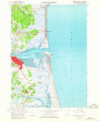
1966 Map of Newburyport East
USGS Topo · Published 1968About this map
Newburyport and the surrounding coastal marshlands define this mid-1960s survey of the Massachusetts and New Hampshire border. The landscape is dominated by the massive estuary system where the Merrimack River meets the Atlantic Ocean at Joppa Flats. Urban detail in Newburyport includes institutional landmarks like City Hall, the Ymca, and the Immaculate Conception Church, while the historic core is anchored by the First Parish Burying Ground and Oak Hill Cem.
Find a feature on this map
91 named features on this map. Tap any name to fly to it.
Don’t see what you’re looking for? This feature index may not catch every label — zoom into the map to look around manually.
Map Details
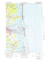
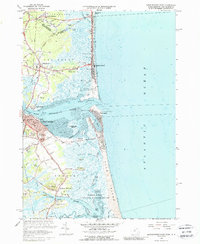
Editions of this 1966 Newburyport East Map
3 editions found
Other maps of this area

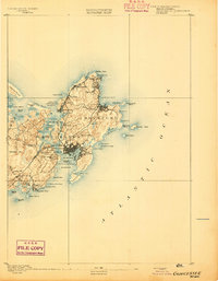
1886 · Gloucester
USGS Topo · 1:62,500

1888 · Newburyport
USGS Topo · 1:62,500

1888 · Gloucester
USGS Topo · 1:62,500

1888 · Salem
USGS Topo · 1:62,500

1890 · Newburyport
USGS Topo · 1:62,500

1893 · Salem
USGS Topo · 1:62,500
1893 · Gloucester
USGS Topo · 1:62,500

1894 · Newburyport
USGS Topo · 1:62,500

1917 · Salem
USGS Topo · 1:62,500

1918 · Gloucester
USGS Topo · 1:62,500