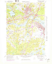
1968 Map of Newburyport West
USGS Topo · Published 1979About this map
The Merrimack River serves as the dominant geographic anchor for this region, separating the industrial and residential centers of Amesbury and Newburyport from the more pastoral landscapes of West Newbury. In the late 1960s, the landscape shows a mix of traditional New England town planning and mid-century infrastructure, evidenced by the path of Interstate 95 cutting across the eastern portion. Academic institutions like the Governor Dummer Academy and Cardinal Cushing Academy are prominent landmarks, reflecting the area's long-standing educational heritage.
Find a feature on this map
83 named features on this map. Tap any name to fly to it.
Don’t see what you’re looking for? This feature index may not catch every label — zoom into the map to look around manually.
Map Details
Editions of this 1968 Newburyport West Map
4 editions found
Other maps of this area

1886 · Lawrence
USGS Topo · 1:62,500

1888 · Newburyport
USGS Topo · 1:62,500

1888 · Haverhill
USGS Topo · 1:62,500

1888 · Lawrence
USGS Topo · 1:62,500

1888 · Salem
USGS Topo · 1:62,500

1890 · Haverhill
USGS Topo · 1:62,500

1890 · Newburyport
USGS Topo · 1:62,500

1893 · Salem
USGS Topo · 1:62,500

1893 · Lawrence
USGS Topo · 1:62,500

1893 · Haverhill
USGS Topo · 1:62,500