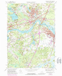
1968 Map of Newburyport West
USGS Topo · Published 1988About this map
The Merrimack River serves as the central artery for this coastal region, dividing the industrial and residential hubs of Amesbury and Newburyport. During the late 1960s, the landscape reflected a balance of historic settlement and mid-century infrastructure, with the Whittier Memorial Bridge carrying modern traffic over the water near older riverside communities like Merrimacport and Salisbury Point. Notable educational and religious institutions are scattered throughout the quadrangle, including the Governor Dummer Academy in the south and Cardinal Cushing Academy in West Newbury.
Find a feature on this map
137 named features on this map. Tap any name to fly to it.
Don’t see what you’re looking for? This feature index may not catch every label — zoom into the map to look around manually.
Map Details
Editions of this 1968 Newburyport West Map
4 editions found
Other maps of this area

1886 · Lawrence
USGS Topo · 1:62,500

1888 · Newburyport
USGS Topo · 1:62,500

1888 · Haverhill
USGS Topo · 1:62,500

1888 · Lawrence
USGS Topo · 1:62,500

1888 · Salem
USGS Topo · 1:62,500

1890 · Haverhill
USGS Topo · 1:62,500

1890 · Newburyport
USGS Topo · 1:62,500

1893 · Salem
USGS Topo · 1:62,500

1893 · Lawrence
USGS Topo · 1:62,500

1893 · Haverhill
USGS Topo · 1:62,500