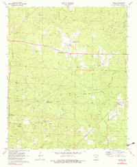
1971 Map of Newell
USGS Topo · Published 1983About this map
The industrial energy landscape of Union County is visible in the early 1970s, dominated by the sprawling Cairo Oil and Gas Field and Shuler Oil and Gas Field. These energy reserves are supported by an extensive network of pipelines and a central pumping station, illustrating the region's mid-century economic reliance on petroleum extraction. Amidst the oil infrastructure, the small community of Newell and the settlement of Lisbon maintain their rural character, connected by state road 82 and local landmarks like the El Dorado Airport (Goodwin Field).
Find a feature on this map
34 named features on this map. Tap any name to fly to it.
Don’t see what you’re looking for? This feature index may not catch every label — zoom into the map to look around manually.
Map Details
Editions of this 1971 Newell Map
3 editions found
Other maps of this area

1927 · El Dorado
USGS Topo · 1:62,500

1930 · El Dorado
USGS Topo · 1:62,500

1951 · El Dorado
USGS Topo · 1:62,500

1953 · El Dorado
USGS Topo · 1:250,000

1957 · El Dorado
USGS Topo · 1:250,000

1958 · El Dorado
USGS Topo · 1:250,000

1960 · El Dorado
USGS Topo · 1:250,000

1962 · Lisbon
USGS Topo · 1:24,000

1962 · Smackover
USGS Topo · 1:24,000

1962 · Mt Holly
USGS Topo · 1:24,000